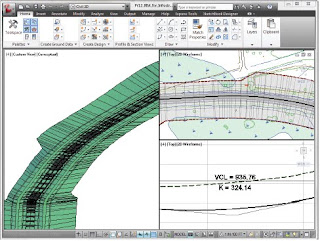
 AutoCAD Civil 3D enables you to explore multiple options, ultimately helping you produce an optimized design. The integration of imagery and geospatial data assists in identifying an optimal solution early in the overall process, helping to save time and money.
• Import geospatial data, such as soil types, land use information, and environmental constraints to more quickly analyze and better understand the probable impacts of different alternatives.
• Use imagery and terrain models from Google Earth™ mapping services and other sources to help visualize the ecosystem of a project.
• Most project data—such as survey information, surfaces, profiles, horizontal alignments, and
corridor models, as well as related annotations and labels—have predictable relationships with other elements in your design. This results in the dynamic updating of model elements when related elements are changed.
• AutoCAD Civil 3D includes terrain shaping tools that support large-surface models while
maintaining dynamic relationships to source data, including contours, break lines, corridor models, and grading objects.
• Use surfaces as references for creating profiles, sections, and corridors. Any changes to the source data result in automatic updates to surfaces and references, which helps you save time and reduce errors. This means that several alternatives can be evaluated quickly since immediate feedback is given, helping to ensure important design constraints are held, such as project limits staying within existing rights of
way.

No comments:
Post a Comment
Note: Only a member of this blog may post a comment.